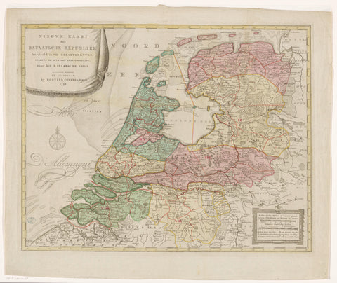
Map of the Batavian Republic, 1798, anonymous, 1798 Canvas Print
Map of the Batavian Republic, divided into eight departments, according to the Act of State Regulation of April 23, 1798. Top left title cartouche. At the bottom right two scale sticks: Hollandsche mylen of uuren gaans / Lieues d'Hollande ou heures de chemin, Gemeene Duitsche mylen / Lieues communes d'Allemagne. Degree distribution along the edges.
-
100% Made In America
-
Next Day Shipping Available
-
100% Money Back Guarantee
-
Free Shipping On Orders Of $150+
-
Use Shopify Pay to break the price down into 4 easy payments!
Select Your Size
